If your adventurous heart longs to undertake mysterious journeys on foot, then a hiking GPS should be a preferred gadget to ensure that you are always on the right track. This article reviews the best brands of hiking GPS devices in the market.
A hiking GPS also known as a ‘Walking’ or a ‘Hand held’ GPS helps users know their exact geographical position. An extremely popular gadget, it is usually preferred by those who indulge in adventurous recreational activities. A hiking GPS uses the satellite based Global Positioning System, managed by the US Department of Defense to identify its location. The system is dependent on satellites that broadcast signals from the outer space to the earth.
At present, even smart phones come with an internal GPS or its operating system offers some excellent navigational apps, but operating these phones in rough terrain is extremely risky. They can easily get damaged, shut down due to water exposure and even run out of battery. However the present generation GPS devices are 100% waterproof, rugged, and have batteries that can run for almost 14 to 18 hours on a single charge.
Hiking is great fun, but getting lost in unfamiliar destination can be annoying and quite dangerous. In such instances, a hiking GPS can prove extremely helpful not only for hikers or outdoor sports enthusiasts but also for forest officers, wildlife photographers, and law-enforcement agencies.
Best Hiking GPS Devices
GARMIN eTREX 30x
- Screen Resolution – 240 x 320 pixels
- Button or touch – Button
- Built in Memory – 3.7 GB
- Weight – 5 ounces
- Dimensions – 2.1″ x 4.0″ x 1.3″
- Battery/ Battery life – 2 AA/ 25 hours
- Price – USD 299
- Position Accuracy – WAAS enabled 3 meters
The eTrex 30x has six buttons : zoom in, zoom out, menu, back, power, and thumb stick respectively. Unlike the eTrex 10 it has a colorful screen, tri-axial electronic compass, barometric altimeter, wireless sharing, and Garmin Chirp technology; and unlike the eTrex 30, it has got City Navigator NT for turn by turn direction. The interface is user friendly; you can see the calender and also create your own profile that saves your data. There is a provision to change the main menu order as per your will. The only con of this device is the small screen that makes it difficult to locate yourself while you are in motion. Overall the hikers and bikers have spoken very highly of this device owing to its small size and excellent battery life.
GARMIN GPSMAP 64ST
- Screen Resolution – 160 x 240 pixels
- Button or touch – Button
- Built in Memory – 8 GB
- Weight – 8.1 ounces
- Dimensions – 2.4″ x 6.3″ x 1.4″
- Battery/ Battery life – 2 AA/ 16 hours
- Price – USD 349.99
- Position Accuracy – 3 meters
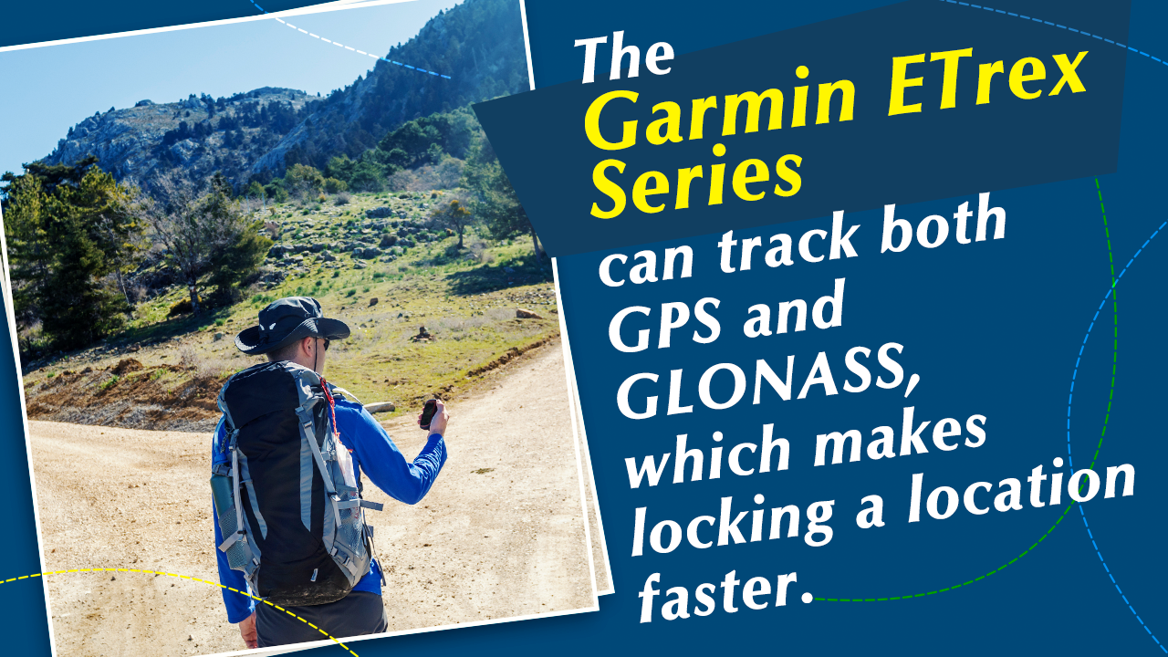
The GPSMAP 64ST is a 3-axis tilted electronic compass with barometric altimeter, and a 2.6 inch sunlight-readable screen. It comes with a wireless connectivity, preloaded TOPO 100K, a one year subscription of BirdsEye Satellite Imagery. It’s helix antenna tracks both GPS and GLONASS, which leads to better and faster positioning. As compared to the eTrex 30x it’s larger and heavier which are also its drawbacks. The bigger size makes it less handy, which is an acute requirement during adventure trips.
GARMIN eTrex 20x
- Screen Resolution – 240 x 320 pixels
- Button or touch – Button
- Built in Memory – 3.7 GB
- Weight – 5 ounces
- Dimensions – 2.1″ x 4.0″ x 1.3″
- Battery/ Battery life – 2 AA/ 25 hours
- Price – USD 199.99
- Position Accuracy – WAAS-enabled 3 meters
The Garmin GPSMAP 62 comes with a built-in worldwide base map with shaded relief, which makes navigation a piece of cake. With its high-sensitive WAAS-enabled GPS receiver and HotFix satellite prediction, the device can determine the user’s exact position even in the remotest location. It also has got City Navigator NT for turn by turn direction. It has got a 64k sunlight readable screen. It is compact and lightweight. The GLONASS tracking improves the accuracy. There is no barometric altimeter, no wireless feature, and according to popular consensus the base map provided does not serve the purpose. Although the cons are greater in number people have shown great interest in buying this device for the great battery life and the accuracy that equals the eTrex 30.
GARMIN inReach Explorer Plus
- Screen Resolution – 200 x 265 pixels
- Button or touch – Touch
- Built in Memory – 2 GB
- Weight – 6.7 ounces
- Dimensions – 2.7″ x 6.5″ x 1.5″
- Battery/ Battery life – Lithium polymer / 100 hours with 10 minute tracking mode
- Price – USD 450
- Position Accuracy – 5 meters
The device is rugged with a 100 % global coverage. It provides a global two way messaging system and also SOS message facility for customer safety. However for the text message, you need to have a subscription. The device is waterproof and dust proof, it’s equipped with digital compass, barometric altimeter, accelerometer, and odometer. It also provides a route planning feature. But the service fees is too expensive and the topographic maps are only available in Earthmate cell phone app. Overall the device is rugged in use and is resistant to water and dust, which makes it a perfect mate for adventure trips. The standout thing for this device is its global coverage, that offers 100% connectivity.
GARMIN OREGON 650T
- Screen Resolution – 240 x 400 pixels
- Button or touch – Touch
- Built in Memory – 4 GB
- Weight – 7.4 ounces
- Dimensions – 2.4″ x 4.5″ x 1.3″
- Battery/ Battery life – 2 AA/ 16 hours
- Price – USD 549.99
- Position Accuracy – WAAS-enabled 3 meters
The OREGON 650T has a got a sunlight-readable touch screen. It has a 3-axis compass with accelerometer and barometric altimeter. It has a built-in 8MP auto focus camera that allows you to take pictures of the route and the scenery around. It comes with two battery system: one is the inbuilt rechargeable NiMH pack which can be replaced with 2 AA batteries, which doubles the battery life. It has wireless sharing. The cons include too sensitive screen, track log errors and according to the popular consensus it is better hand held than mounted.
In addition to the huge range of GPS models, there are a number of accessories like a battery charger, carrying case, portable friction mount and a USB cable that are available for users. Other than determining the exact locations, a hiking GPS can be used for special activities like geocaching which involves the hunt for treasures hidden outdoors in containers called geocaches. A hiking GPS is an extremely helpful product for people who are frequent travelers and often indulge in hiking trips in unknown territories.